
Spatial browsing
React · MapLibreA responsive map-first interface for exploring fields and observations.
 Book a call
 01 · Queryable training data
AI Library turns raw field imagery into searchable training data. Every image stays connected to its field, crop, growth stage, weed, device and capture date — making it possible to isolate exactly the conditions a model needs.
242matching imagesfor this training condition

02 · Spatial provenance
Images remain linked to the field observation that produced them — including capture date, crop conditions and device metadata. The dataset keeps its real-world origin visible all the way down to an individual photo.
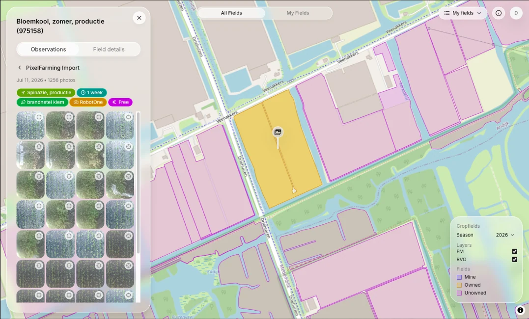
Spatial origin of the dataset
Capture event with agricultural metadata
Images stay linked to their source context
03 · Spatial architecture
AI Library uses vector tiles to stream only the geographic detail needed for the current view — keeping the map fast from country scale down to individual fields.
Field boundaries, observations and image metadata live in one spatial data layer.
Only the geometry needed for the current viewport and zoom is sent to the browser.
Users move smoothly from regional overview to individual fields and observations.
04 · User-owned data
Ownership and access are part of the data model, not an afterthought. Rights stay attached to field imagery from the moment it enters the library.
Portable identity and user-controlled storage keep the platform from becoming another data silo.
05 · One stack, one team
One team designed the domain model, map delivery, application layer, user experience and release coverage as a connected product.
A responsive map-first interface for exploring fields and observations.
A typed path from the interface to domain data and actions.
Field boundaries, observations and image context in one model.
Portable identity and a user-controlled data layer.
Critical product flows checked before every deploy.
Have a geospatial product in mind?